
It’s been a couple days since the last time snowstorm, so I guess that means we’re due for another! Regardless of what schedule you prefer our snow to be on (I actually like this frequency a lot!) get ready because we have more coming tomorrow. A deepening low pressure system will track directly across our region bringing yet another round of accumulating winter weather to the region. This storm has the potential to be the most challenging of the winter storms we have received in the last couple weeks, as freezing rain, heavy snow, and gusty winds will combine to make travel treacherous throughout the day Thursday, especially in the afternoon.

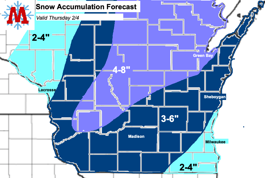
The storm will get underway early tomorrow morning, beginning with a brief round of freezing rain for Madison and points west. This has the potential to produce a light glaze of ice on untreated surfaces for the morning commute so use caution when traveling. The precipitation will then transition over to snow as it spreads across the region throughout the morning. Snow accumulations of 3-6 inches are expected for most of region, including Madison. To the North, higher amounts in the range of 4-8 inches are likely. Lower amounts are expected to the southeast, with 2-4 inches forecasted for Milwaukee. The snow will be heavy Thursday afternoon, as fairly intense banding will likely develop over the region. These bands will create rapid snow accumulation on roadways and will combine with gusty winds to produce poor visibility and blowing snow. Based on this, travel is expected to be difficult throughout the late morning and afternoon Thursday. Areas that receive the heaviest banding will likely see snow totals around half a foot. Snow will end from West to East Thursday evening.
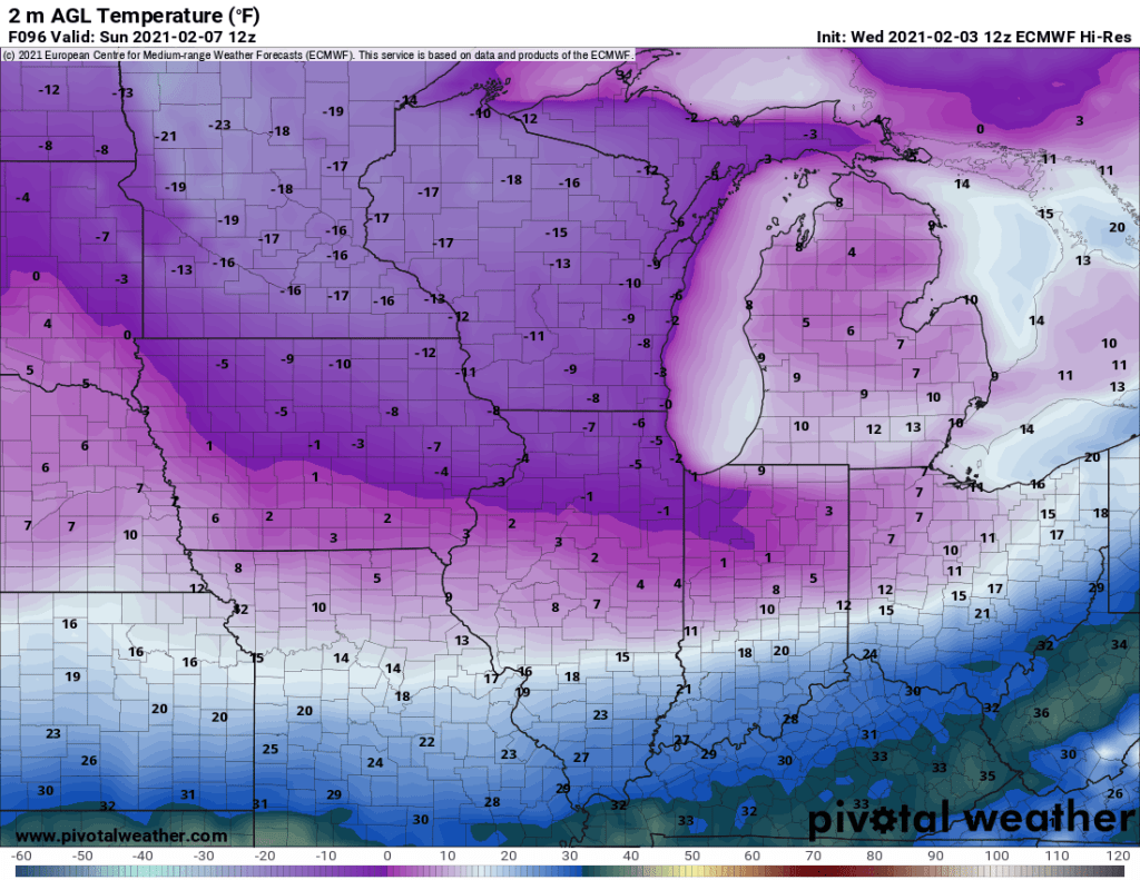
As the snow ends, brutally cold air will enter the region. This will be the strongest cold wave we have experienced so far this winter with lows in the negative teens possible Sunday morning. Well below normal temperatures beginning Friday and persisting throughout the weekend will cause any snow that is not removed quickly to turn into ice. If possible we recommend shoveling promptly and thoroughly after the snow ends Thursday night. Additionally, it will be difficult for plow crews to get roads cleared to pavement as road salt will be less effective at these temperatures. Be alert for slick spots that may remain throughout the weekend. Below normal temperatures are forecasted to continue throughout next week. Bundle up!
