
Thursday, December 10, 9:15pm
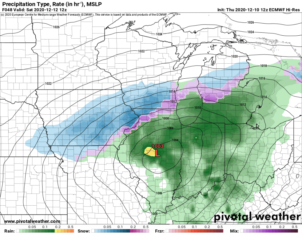
A developing low pressure system is currently forecasted to pass to our south Friday night through Saturday, and will bring wintry precipitation and gusty winds to the region. Precipitation may start as a wintry mix in the Madison area before quickly transitioning to all snow. Madison will experience accumulating Friday night through Saturday. Areas to the south and east, and especially locations adjacent to the lake shore are forecasted to receive a longer period of wintry mix, which will lead to lower snow accumulations. This will be a result of strong winds out of the Northeast advecting warm air from Lake Michigan.

Above is our current snowfall forecast for this storm. The highest snow totals will fall along a narrow band that we are currently forecasting to be oriented across the region along a line from Platteville, through Madison and towards Sheboygan. Areas to the South and North will experience lower snow totals. There will likely be a sharp cutoff in snow accumulations to the North as dry air advection as a result of the deepening low pressure will cut down on available moisture.
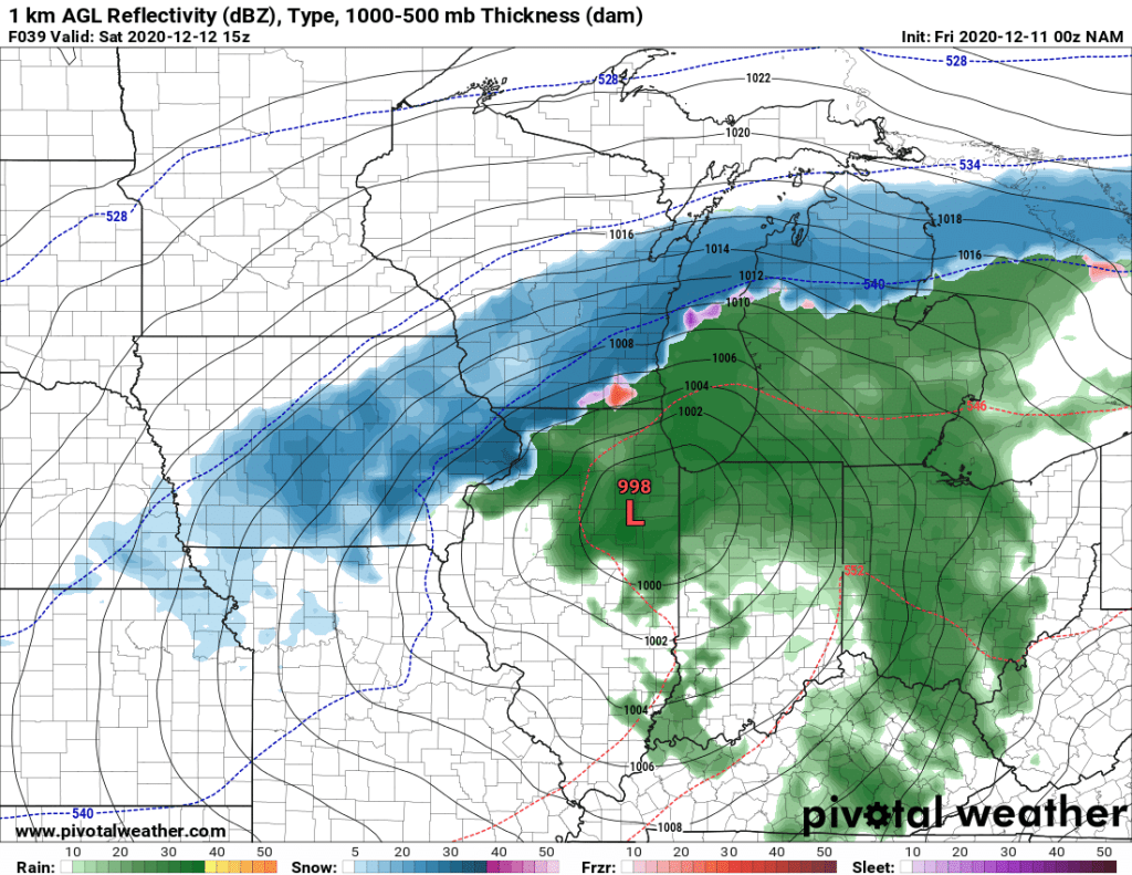
There remains considerable uncertainty regarding the exact amount of snow that will fall as a result of this storm, and while we are confident in this forecast, there is potential for amounts to either fall short of or exceed the ranges indicated here. Uncertainty is especially high along the Northern edge of the snowfall as small changes in the track of the storm could lead to higher or lower amounts. The NAM model in particular is indicating the potential for a considerably heavier snow event; however, it remains an outlier at this time and is prone to over amplifying storms. While the NAM’s solution is unlikely, it would be imprudent to completely discount the possibility of heavier snowfall at this time.
As it currently stands, Madison and other localities within the band of heaviest snow accumulations will experience plowable snow and difficult travel. Areas along the lakeshore will be less impacted by snow accumulations. However those areas will receive strong winds and will likely experience lake shore flooding. Make sure to exercise caution if traveling and stay updated on the forecast. This remains an evolving situation and we will be working to provide forecast updates on this blog as well as our twitter page as the storm develops.
-HH
