The outlook for this week is relatively quiet. With the assistance of the short and mid-range forecasts from the National Oceanic and Atmospheric Association (NOAA), we can make some predictions on what this week will look like around Madison.
Monday, November 16th
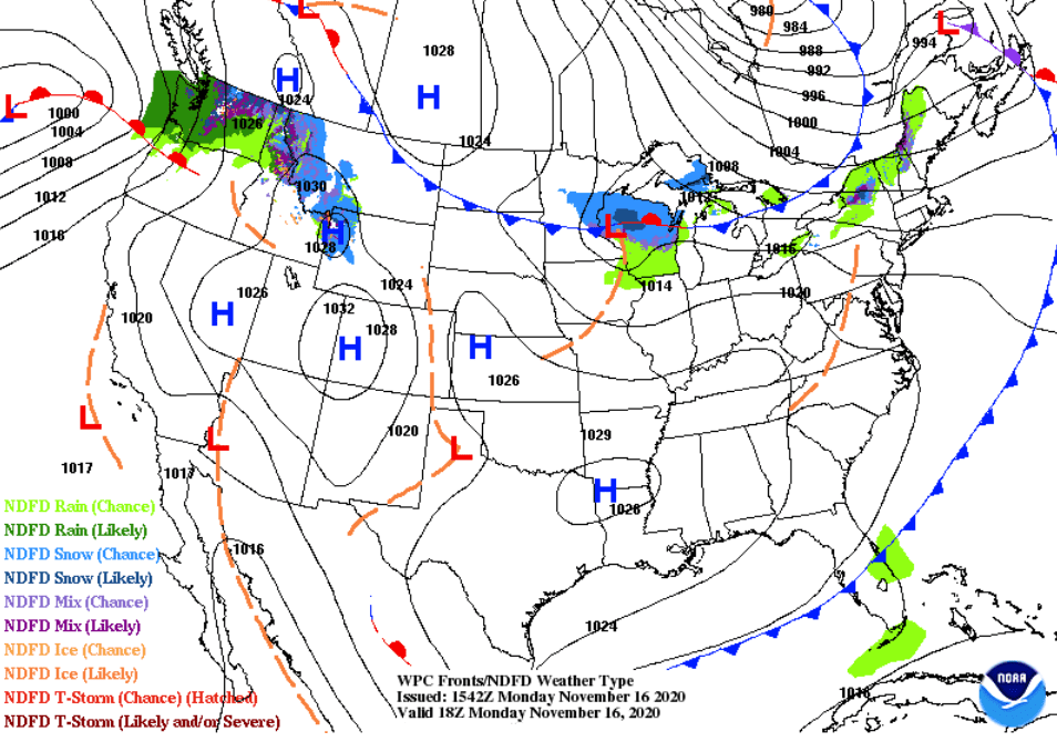
There are a few things to point out here. First, a low pressure system that will be moving through the heart of Wisconsin could bring with it some precipitation. The northern half of the state could possibly see a small accumulation of snow due to a stationary front holding temperatures just below freezing to its north (~26°F – 32°F). Madison would likelier see some colder rain showers, but light snow is possible.
Tuesday, November 17th
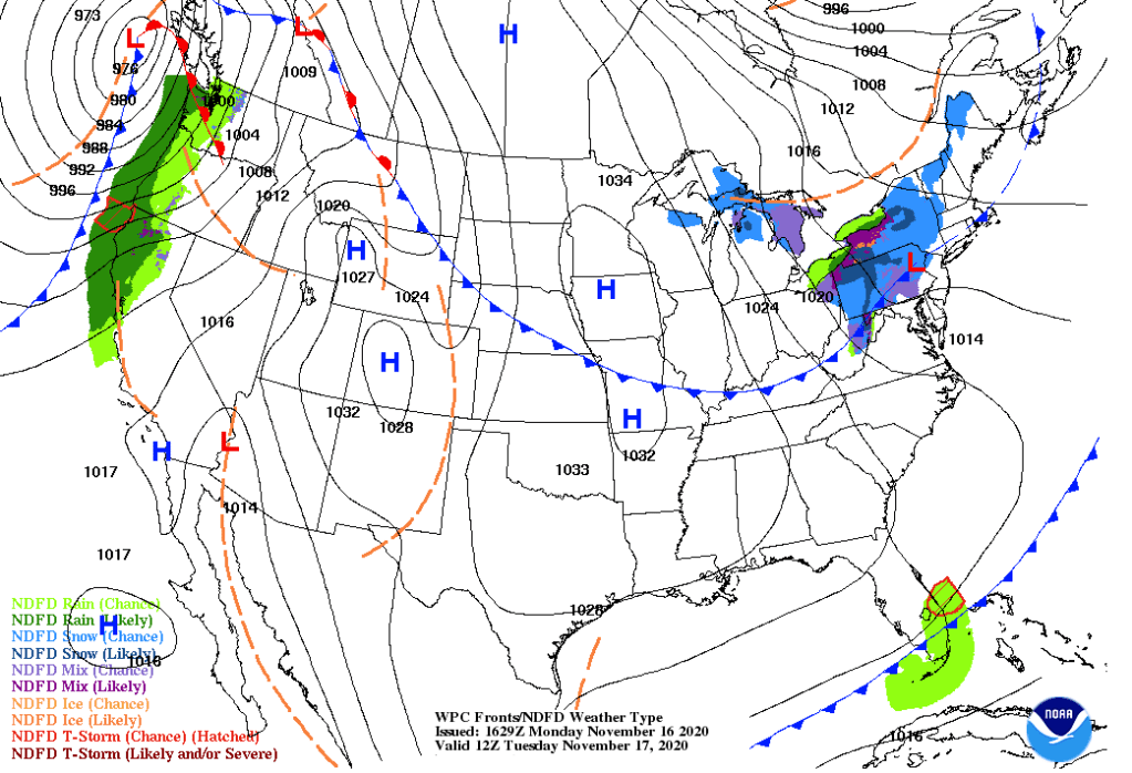
As the surface low pressure system moves out of Wisconsin and the Midwest, the state will see relatively calm conditions. Weaker winds, sunny skies, and slightly cooler temperatures (~38°F – 40°F) will prevail from the high pressure system to the west. Something to keep in mind as we move forward is the intense cyclone and surface low pressure system moving towards Washington state, bringing with it some precipitation.
Wednesday, November 18th
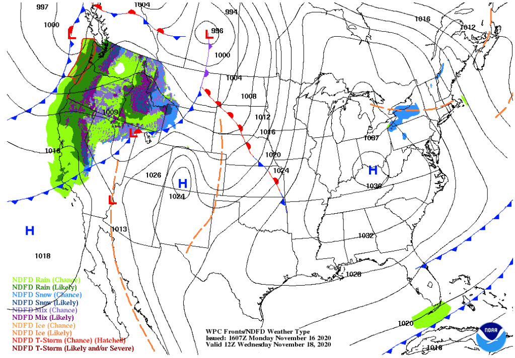
Wednesday will see similar conditions from Tuesday. Sunny, little to no wind, but will see a fairly pleasant rise in temperature. The movement of air along the cyclone (now moving through Saskatchewan, CA) will pull some slightly warmer air from the southern U.S. and give Madison residents a little bit more warmth (~46°F – 50°F). The precipitation trailing the cold front also begins to take effect across multiple states.
Thursday, November 19th

Madison residents will likely enjoy their last super-60°F day of 2020 on Thursday. The warmer air being advected northward from the surface low pressure systems in northern Ontario, CA and eastern South Dakota will hopefully be a late-November gift one last time before winter truly sets in. The system could also bring a few clouds with it and some stronger winds that in days previous, but warmer temperatures could linger into Friday as well.
Friday, November 20th
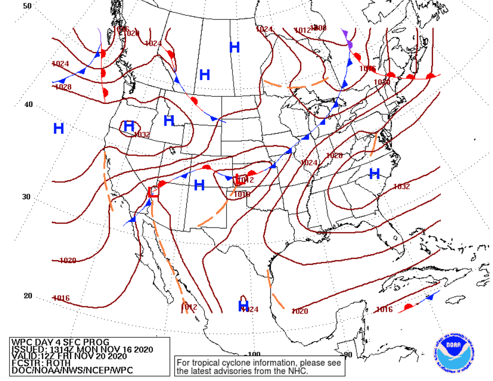
The outlook for the day gets a little messy. We no longer see a ton of organization from the surface low pressure system previously in South Dakota, and the warm temperatures may prevail early in the day but will be brought back down from the cold frontal passage during the day. Temperatures early could be in the high 50’s, but will most likely end up in the low 40’s as the day moves on. With the cold frontal passage, Madison could see some precipitation. Most likely colder, light rain, but a mix or even a few snow flakes are possible depending on how cold the temperatures get.
Saturday, November 21st (Wisconsin Football @ Northwestern)
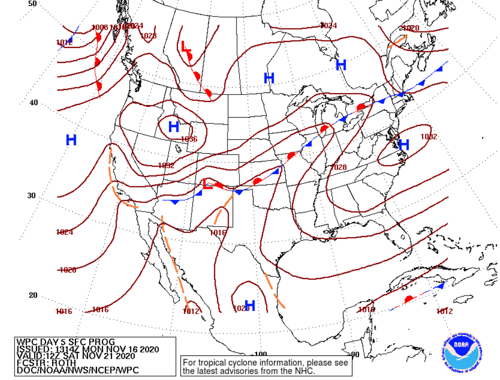
Low 40’s and similar chances of cold rain and mix will bleed into Saturday’s outlook for Madison. The Badgers head south to Evanston, IL to take on Northwestern into slightly warmer temperatures as they move towards the south side of the stationary front in Northern IL. Low 50’s could be the case come game time, but a chance of some rain will still hold true.
Score Prediction: #10 Wisconsin – 24, #19 Northwestern – 21
Classic trap game for the Badgers. Coming off an absolute stomping of Michigan, the Badgers will be riding on some good momentum that will propel them to victory, but not without complications. Northwestern is 4-0 and will put up a fight, especially now that both teams are ranked for the first time since the 1960’s. I think the possible rain doesn’t help either team and the Wildcats will get off to a hot start, but will cool down as the game continues and the stronger Badger defense begins to kill their momentum. Mertz will throw 2 touchdowns and let Nakia Watson take care of the other one, with a late 3rd quarter field goal being the difference.
Sunday, November 22nd
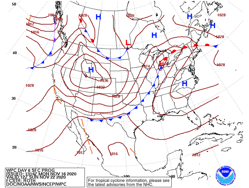
Sunday’s outlook seems slightly less chaotic. The Badgers will come home from a hard fought victory to similar weather during the game. Temperatures lingering in the low 40’s and some unorganized precipitation on the tail-end of the cold front associated with the surface low pressure system over Michigan will give not much of a change in weather from Saturday. Rain, mix, or snow could all be possible on Sunday as an anticyclone and high pressure makes its way towards the state.
Jared Van Bramer
Forecaster
