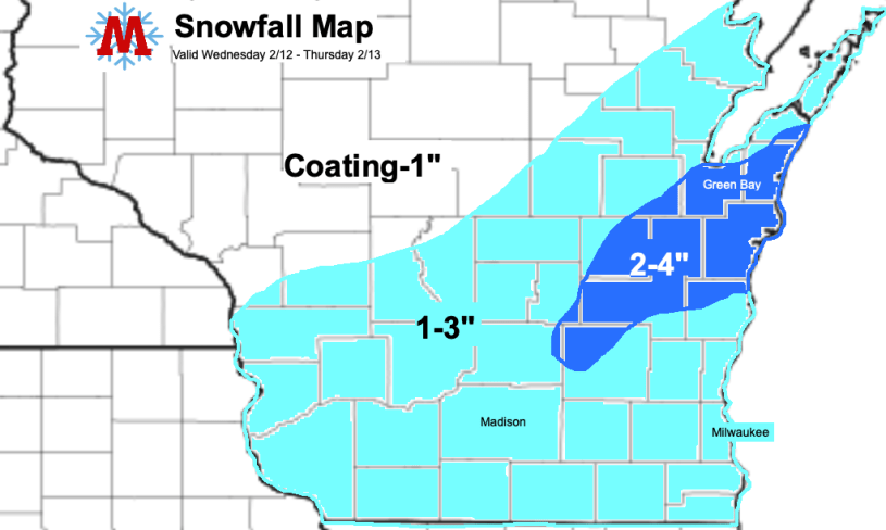
A low pressure system passing to the south and a cold front (more on that later) approaching from the northwest will combine over Southern Wisconsin this evening, producing a round of light snow for the region. Snow will begin between 5 and 6 pm tonight and will likely continue through the Thursday morning commute. 1-3 inches of snow is expected for Southern and Central Wisconsin, with lower totals to the North. Some weather models have indicated potential for a band of heavier snow to set up between Sheboygan and Green Bay, although there is considerable uncertainty regarding exactly if/where this will occur. If this band develops, accumulations of up to 4 inches are possible in that area. Strong winds overnight into Thursday will also produce some blowing and drifting snow.

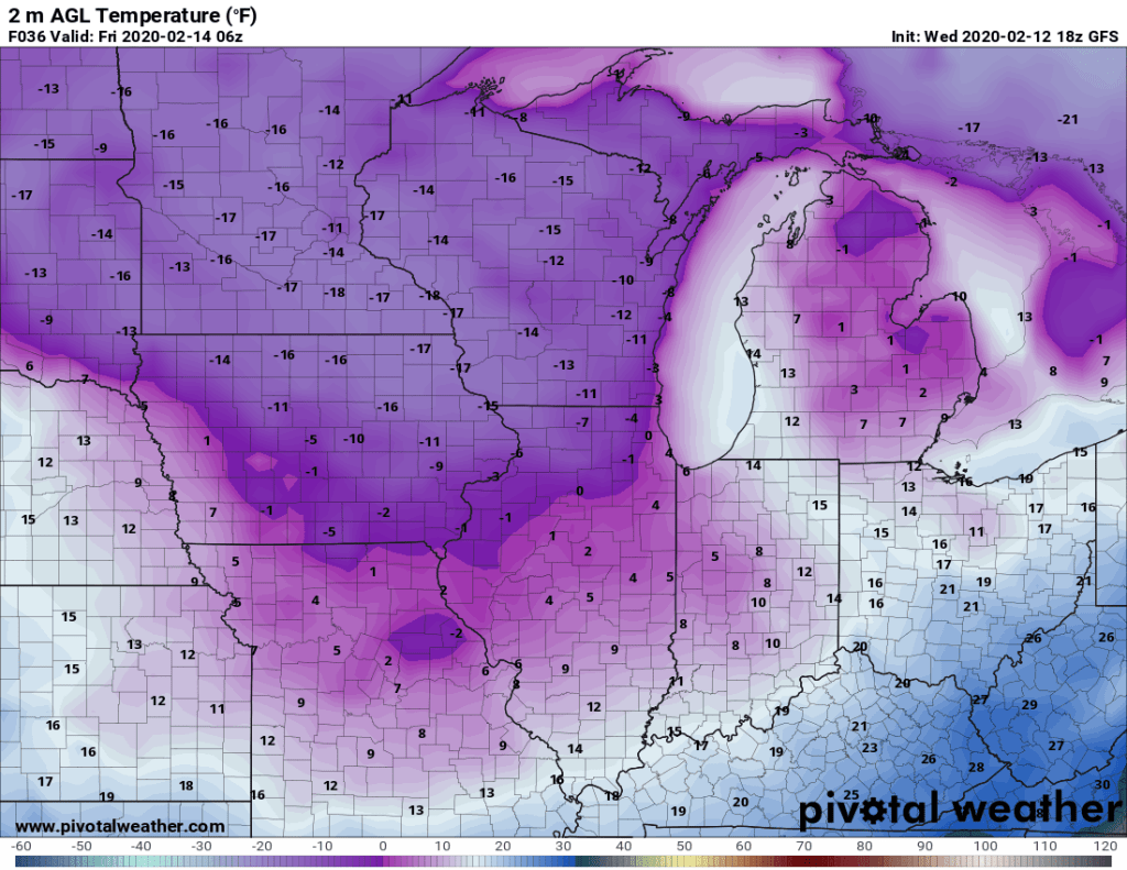
The frontal boundary contributing to the snow will also bring a brutally cold airmass into the Upper Midwest. Temperatures on Thursday will be the coldest we have experienced this winter, falling into the double digit negatives Thursday night into Friday. Wind chill values will likely reach or exceed -20 degrees.
The combination of a couple inches of snow, wind, and cold will make for a difficult Thursday morning commute. Roads will likely be snow covered and slick through the morning, as cold temperatures will significantly hamper plow crews’ ability to use salt to melt away snow and ice. Walking will not be much better. It is going to be painfully cold; wear layers and try to limit exposure. Fortunately temperatures will significantly moderate by Saturday, so we only have to survive a day or two of this. I like our chances.
