
What has been a relatively boring/mild/pleasant/ (insert preferred adjective here) period of weather for Southern Wisconsin will come to an end tomorrow morning. Snow will enter the region from the West around 5 am and will spread from West to East during the morning hours. Periods of heavy snow will be possible from mid morning through early afternoon before snow tapers off Sunday evening.
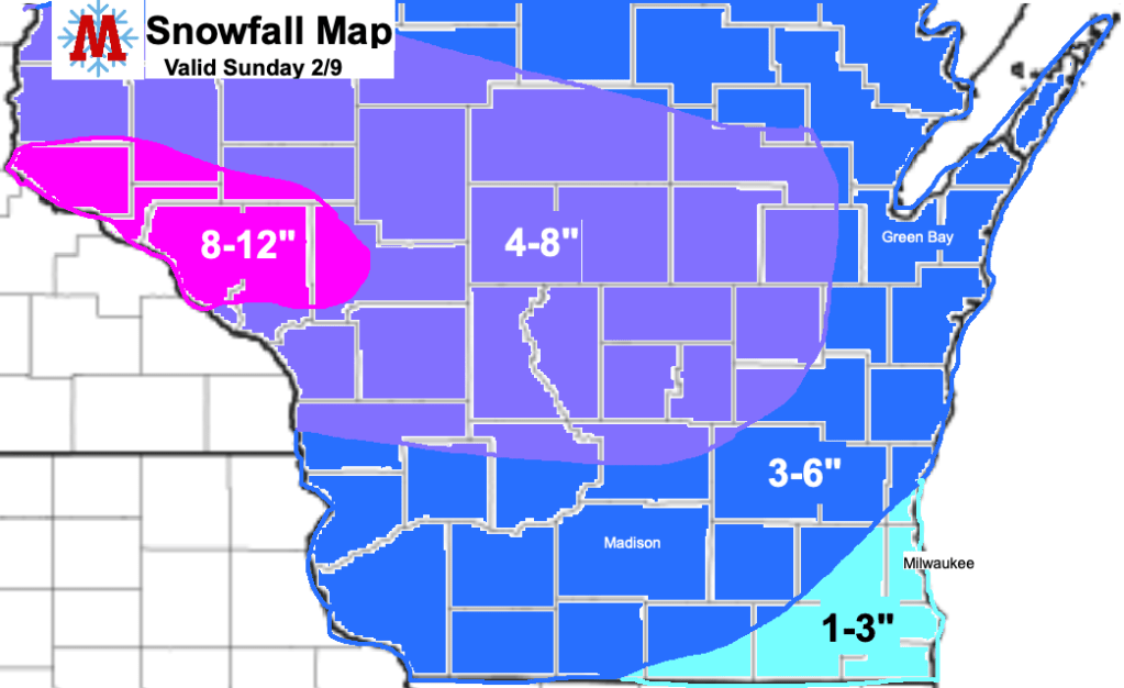
Significant accumulations are expected across much of the region. Madison will likely see 3-6 inches of snow, with more expected to the North and West. Southeastern counties, including Milwaukee will see lower accumulations with totals most likely in the 1-3 inch range.
Snow amounts, combined with high snowfall rates will create hazardous travel conditions throughout the day Sunday, especially for areas along and North of I-94. Snow covered roads are likely during the day Sunday and into the night. If you are traveling expect delays and exercise caution. It’s been much too long since our last solid snowfall in my opinion (I need material for this blog) so be sure to enjoy the snowy end to the weekend.
