
A strong low pressure system will move across the Midwest tonight into Saturday, bringing yet another round of accumulating snow to Wisconsin. While our region will not see the strongest impacts from this storm, that happy distinction belongs to the wide swath of the Dakotas and western Minnesota currently under a blizzard warning, we still will see a significant snowfall here in South and Central Wisconsin, with many areas picking up another half a foot of snow.
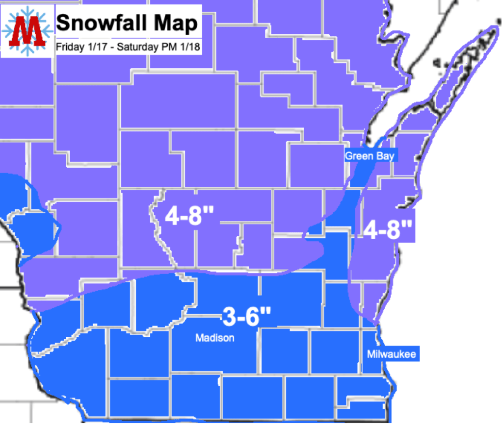
Snow will begin between 3 and 5 pm this evening for the region and will continue overnight into Saturday. The center of the low pressure will pass over Southern Wisconsin, Saturday morning, leading to a period of mixed precipitation as warm air advects into the region from the south. Areas from Madison and to the south have the greatest chance of seeing mixing and as a result their snow totals will be slightly lower. This area will likely see some icing during this period. To the north of Madison, 4-8 inches of snow is expected. Areas along Lake Michigan will likely experience lake enhancement, leading to periods of heavier snowfall rates. Snow will diminish Saturday afternoon as the storm exits the region, although isolated snow showers could remain into Saturday evening. Windy conditions and blowing snow are also possible Saturday
Expect slick, snow covered roads to create difficult travel conditions Friday night through Saturday morning. If you have to drive, be careful and expect delays; it’s January in Wisconsin, you all know the drill by now. Have a great weekend, and enjoy the snow; if this past week was any indication there will be plenty more still to come.
